The whole school in 3D, on the school’s own clock.
The school’s online map showed where things were, but not what Berkley is like. I built a live 3D model of the campus for the school website. It follows Hamilton’s real time and weather, the bus timetable and the bell times, and shows school news and student comments over the places they’re about.
- Live
- On the school website since 14 Oct 2026
- Built from
- 7.5 cm aerial photography and photos of the real buildings
- Testing
- 269 automated checks
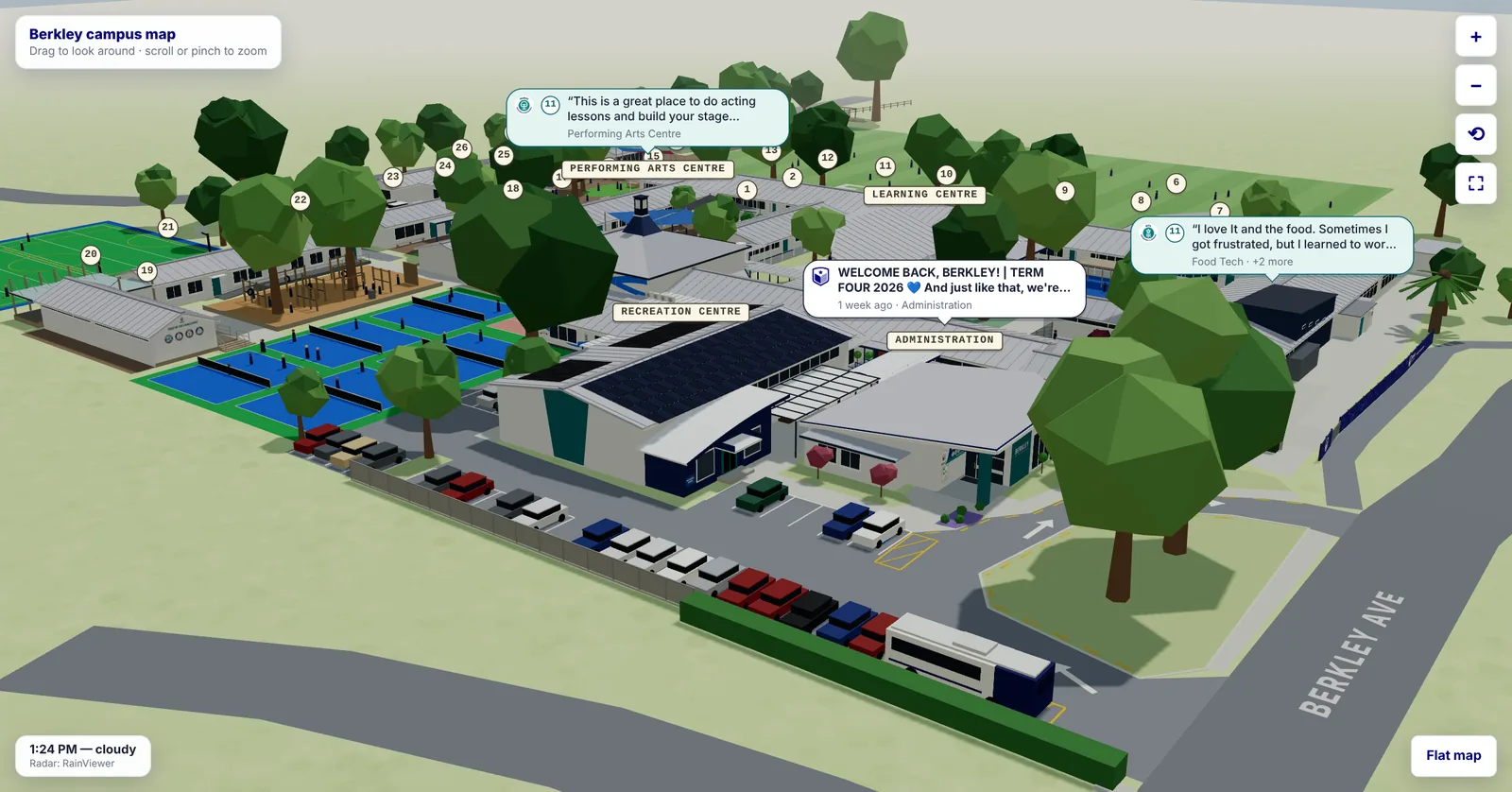
Where things are isn’t what a school is like.
The old campus map was flat. It helped someone find a building, but it couldn’t show a family, a visitor or a new student what a normal day at Berkley looks like.
Measured from the air. Matched to the real buildings.
I built the map on my own, in my own time, using AI to build fast. The layout is measured from LINZ 7.5 cm aerial photography. The buildings are matched to photos of the real thing, down to the murals, the signage and the school’s WERO value roundels.
It’s built with Three.js and has 269 automated checks.
The real clock. The real timetable.
The map runs on Hamilton’s time of day and its real weather, including live rain radar, so drizzle, rain and cloud show up on the campus. After dark, the classroom lights come on.
School buses arrive and leave on their real timetable. Students head out at break and lunch on the school’s bell times, with play before school and sports practice after. Staff cars fill the car park from 8am, and the staff coffee cart turns up at second break. On school mornings, the groundsman mows the field on a ride-on mower.
At weekends, in the school holidays and on public holidays, the campus is empty. Those days come from the school’s own calendar.
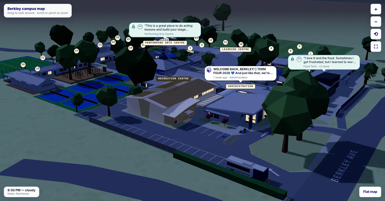
The school’s news. In the students’ words.
The school’s Facebook posts pop up over the building each one is about.
Students send in short comments, 140 characters or fewer, about a place at school they love or something they found hard and pushed through. Each one is tagged with its place and one of the school’s WERO values: Whanaungatanga, Ekea, Raakau or Ora. Every comment is approved before it appears, then pops up over that place for about a week.
A built-in limit allows only a few pop-ups at once, so the map never gets cluttered.
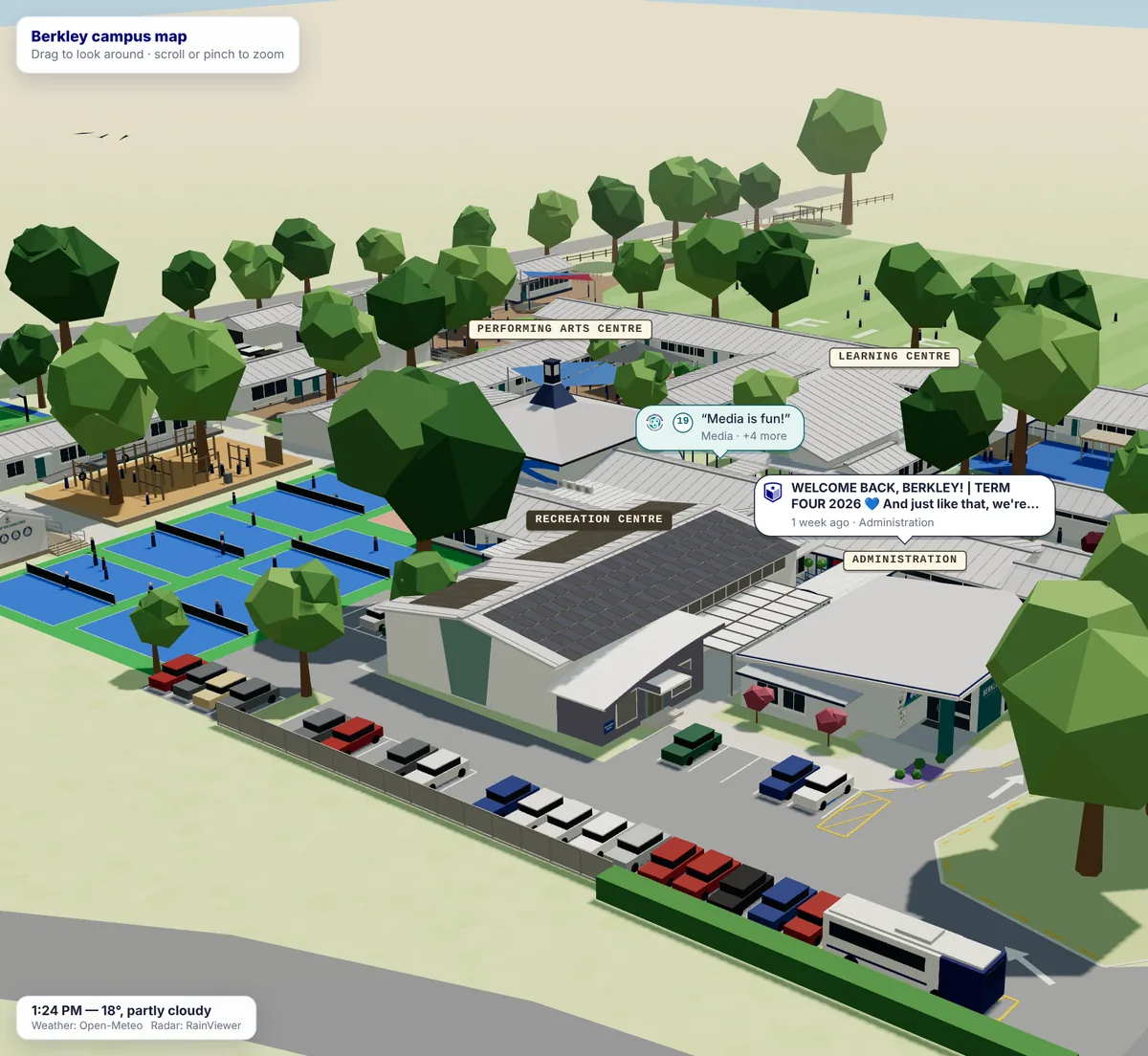
Made for phones. With a flat map fallback.
The map works on phones and sits inside the school website, with a full-screen button. Tap any building to see what it is.
Where a device can’t run 3D, it opens the flat map instead, with 360° tours and room search.
Live on the school website. Figures to come.
The map has been live since 14 October 2026. There are no usage figures yet, and I’ll add them here when there are.
Personal project, built in my own time for Berkley Normal Middle School. Aerial photography from LINZ, licensed CC BY 4.0. Screenshots are from the live map, with the time of day set for each view.
Your data, turned into a place people can explore.
Timetables, calendars, weather and news usually sit in separate systems. Here they drive one model that anyone can open on a phone. The same approach works for a campus, a venue, a site or a property.
In a senior role, I’d look for the information your organisation already publishes and turn it into something people want to explore. On a project, I take one place from measurements to a live launch.
How I approach AI, automation and custom softwareWant one for your school?
I build these for schools and campuses: measured from aerial photography, matched to photos of your buildings and set to your own bell times and calendar.
Email me your school’s name and I’ll tell you what’s involved.
Let's build it.
Hiring for a senior creative technology role, or planning a project that matters? Tell me what you’re trying to achieve and where you’re based. I’m in New Zealand, spent six years in Singapore and am open to remote work or relocation.